ELMF - FLOODED CITY MAPS
ELMF - FLOODED CITY MAPS
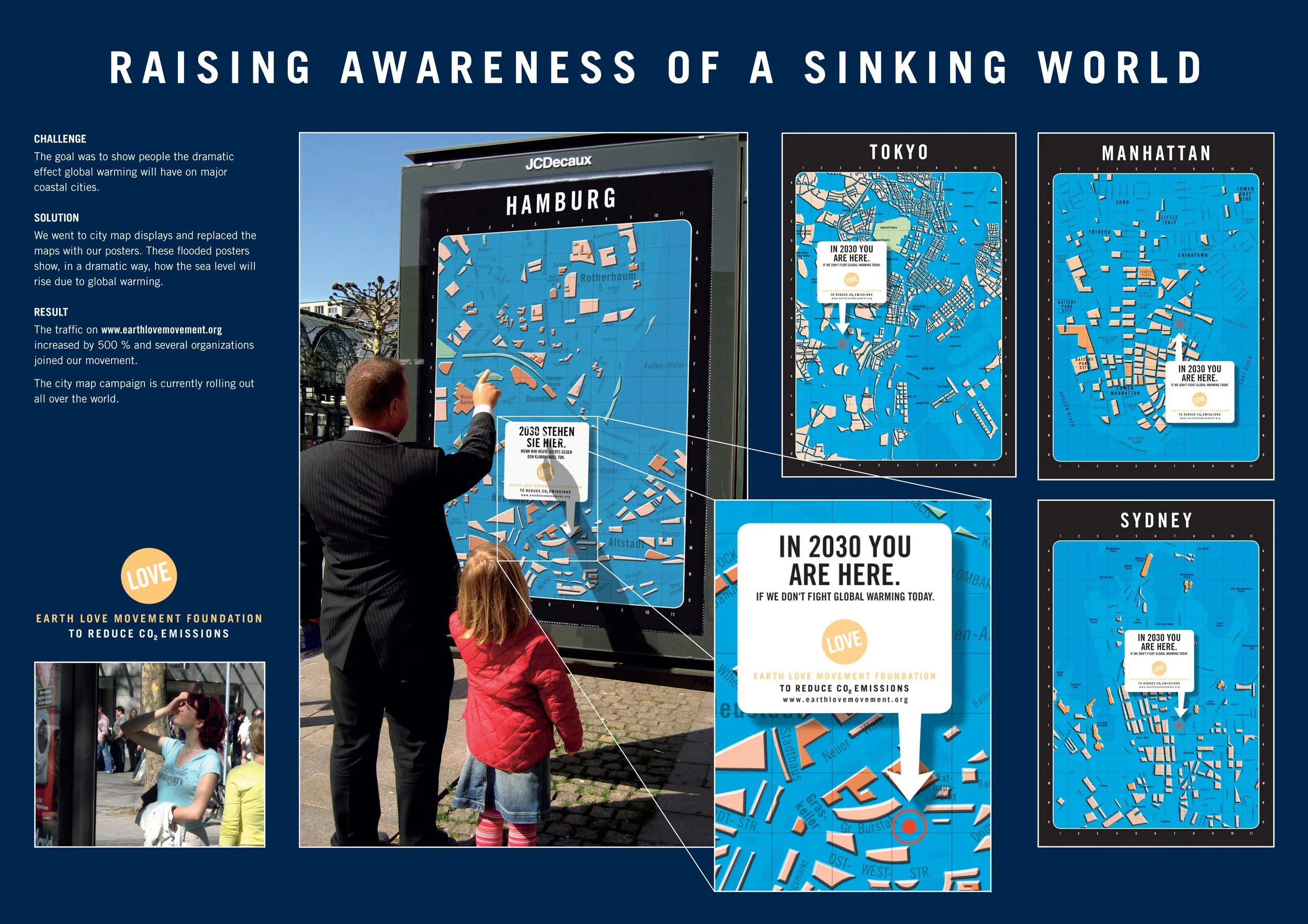
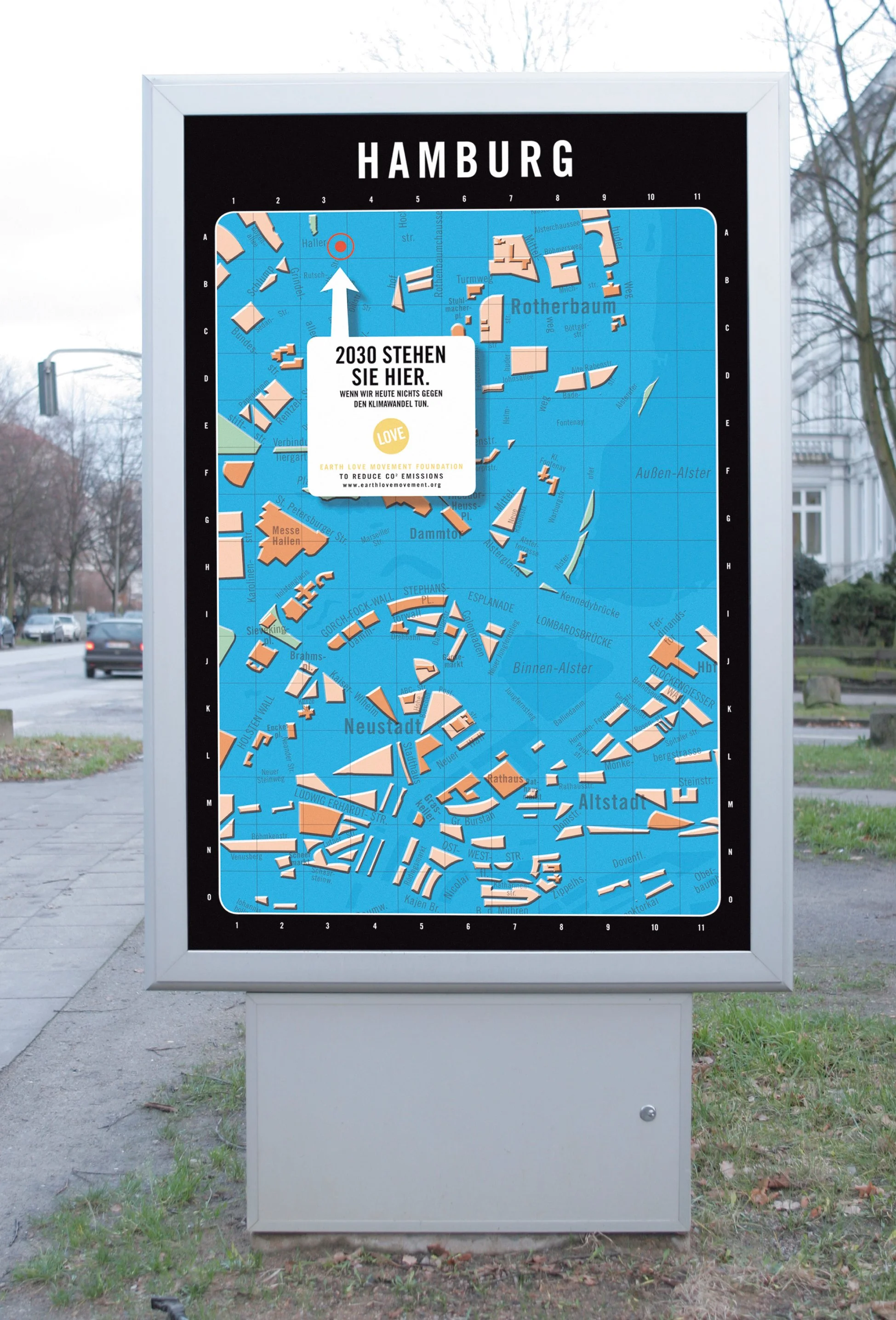
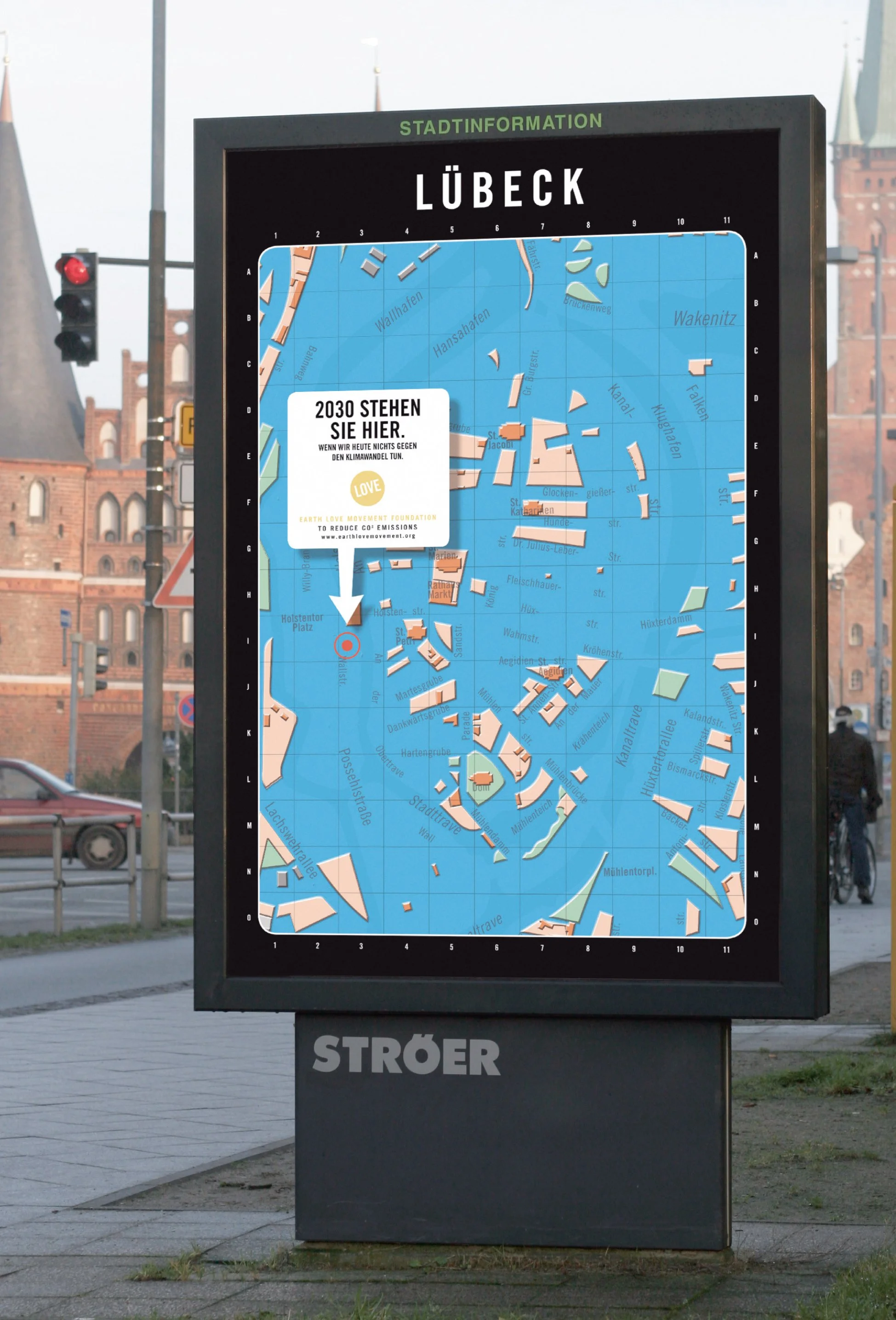
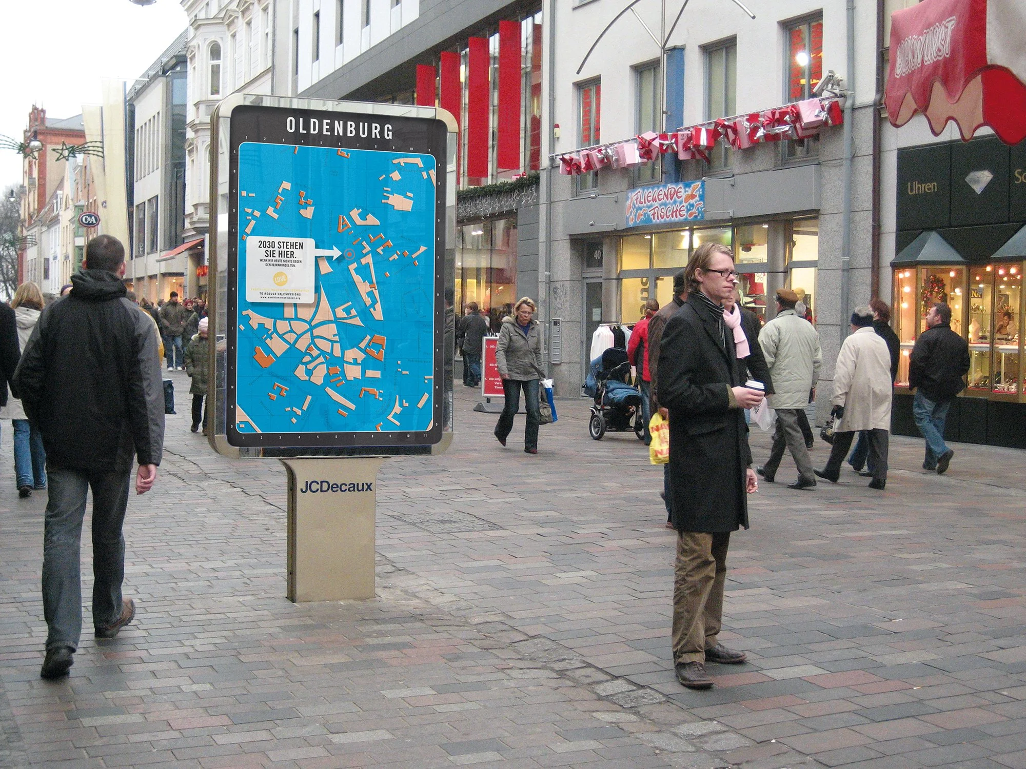
LAND UNDER ON PUBLIC CITY MAPS
————————
GUERILLA | AMBIENT
Unfortunately my work from 2008 is still more topical than ever:
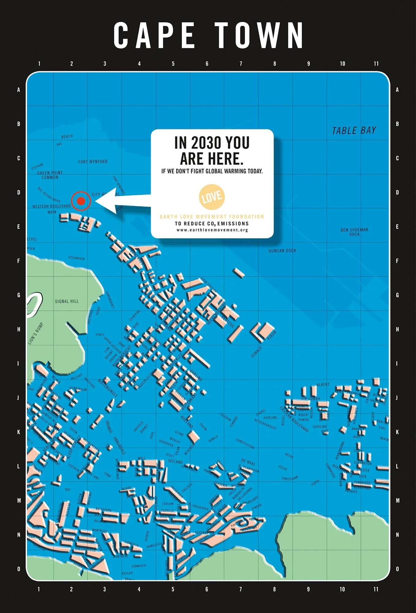
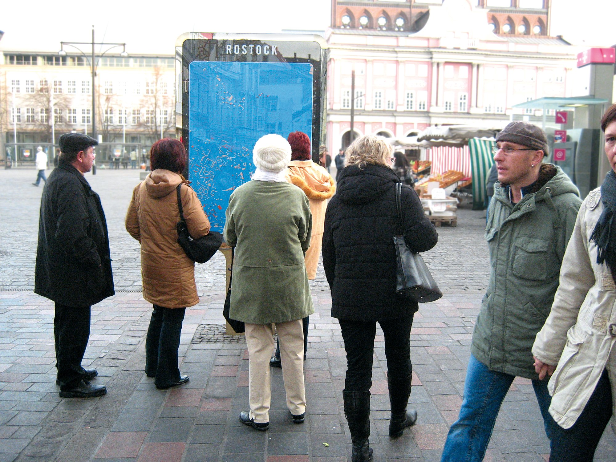
In order to make passers-by aware of the impending consequences of climate change, we replaced the public information city maps of international coastal cities with posters on which the cities are submerged meters high in the water. The "flooded city maps" show where we will be in 2030 if global warming continues to rise and CO2 emissions are not reduced.
The plans were individually calculated and designed for each city on the basis of the available data from 2007 based on a predicted rise in sea level of 2 meters.